Tropical Storm Dorian Update 3
28 August, 2019
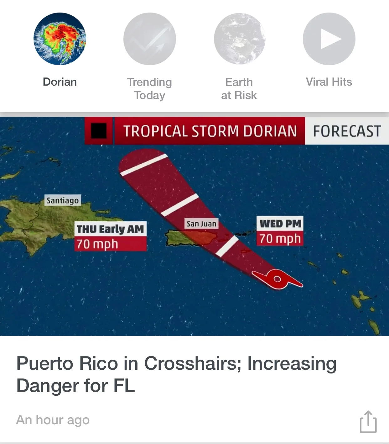
T.S.Dorian has veered north of its original course and is now projected to strike Puerto Rico today with winds to 60 knots. The entire island has been declared an emergency area. Though winds are currently of tropical storm strength, the major effect to PR will be rainfall, estimated by some forecasters to be as much as 10 inches in a 6-8 hour period.
Dorian will exit Puerto Rico late today and continue west-northwestward , passing NE of Grand Turk and skirting the Bahamas. The important thing here is that the storm looks like it will entirely miss the Dominican Republic. There will be minor effects, beginning later today and tomorrow morning in Punta Cana and Las Galeras, but these effects will be the result of outlying bands of the storm's southern (least dangerous) quadrant. The wind may be gusty and skies gray with periods of needed rain.
Further west along the DR north coast, effects of Dorian will lessen with distance. By the time the storm center passes some 100-150 miles north of Puerto Plata and Luperon, impact on these areas will be minimal. Surf will be a factor, however, and caution should be used when near the water. It is possible that the DR government will initiate a no-use rule tomorrow , at least in Cabarete and Sosua.
The coast of the Dominican Republic from Isla Saona north past Punta Cana thence west all the way to Puerto Plata, is still under Tropical Storm Watch. This may be discontinued by tomorrow. As so often happens on the north shore of this country, the current tropical system, Dorian, has veered away and will have only minimal effect on our shores.
Respectfully,
Eric
WeatherWolf